Drone Mapping Explained: Photogrammetry vs LiDAR
Drone mapping has become a critical tool across construction, surveying, mining, agriculture, and infrastructure inspection. Two technologies dominate this space: photogrammetry and LiDAR. While both are used to create accurate 3D models and maps, they work in fundamentally different ways and excel in different environments.
Understanding the strengths and limitations of each method is essential when choosing the right drone, sensor, and workflow for your project.
What Is Photogrammetry?
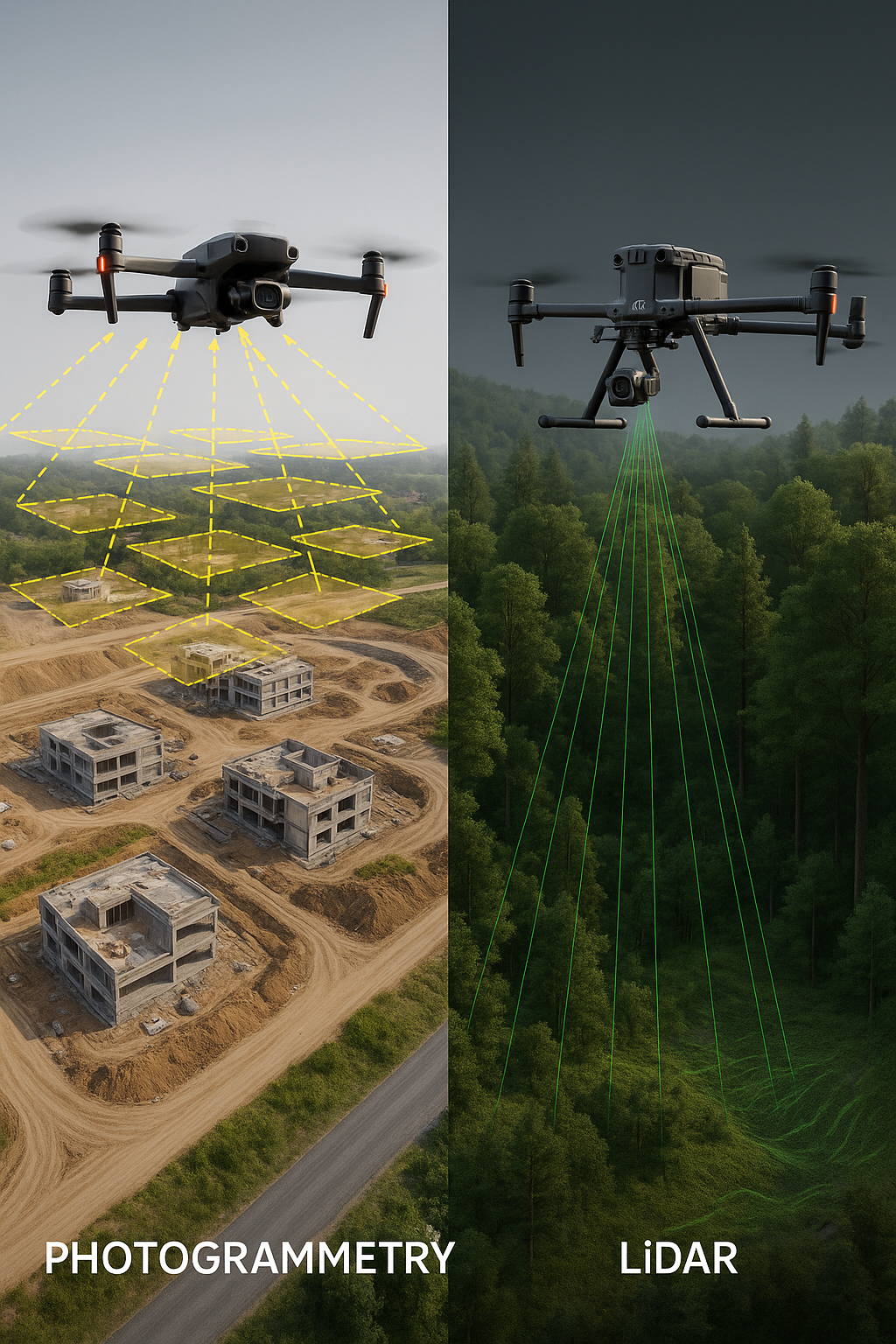
Photogrammetry uses high-resolution images captured from multiple angles to reconstruct a 3D model of the environment. Specialized software analyzes overlapping photos and calculates depth by identifying shared reference points between images.
This approach is widely used because it is cost-effective, visually rich, and supported by many commercial drone platforms, including several DJI models.
Photogrammetry Advantages
- Lower equipment cost
- High-detail, color-accurate imagery
- Excellent for open areas and construction sites
- Compatible with most mapping drones
Photogrammetry Limitations
- Struggles with dense vegetation
- Accuracy depends on lighting conditions
- Requires significant image overlap
What Is LiDAR Drone Mapping?
LiDAR (Light Detection and Ranging) uses laser pulses instead of photos to measure distance. A LiDAR sensor emits thousands of laser points per second, creating an extremely precise 3D point cloud of the terrain below.
Because LiDAR does not rely on visible light, it performs exceptionally well in low-light conditions and can penetrate vegetation to reveal ground elevation.
LiDAR Advantages
- Extremely high accuracy
- Performs well in forests and vegetation
- Reliable in low-light conditions
- Ideal for topographic surveys
LiDAR Limitations
- Higher equipment cost
- More complex data processing
- Limited color information
Photogrammetry vs LiDAR: Accuracy Comparison
Both technologies can achieve survey-grade accuracy when properly configured. Photogrammetry typically delivers excellent horizontal accuracy, while LiDAR excels in vertical accuracy and terrain modeling.
For projects involving earthworks, forestry, or flood modeling, LiDAR is often the preferred choice. For construction progress tracking and visual documentation, photogrammetry remains highly effective.
DJI-Supported Solutions
DJI supports both photogrammetry and LiDAR workflows through its enterprise drone lineup. Models such as the DJI Mavic 3 Enterprise support photogrammetry mapping, while platforms like the DJI Matrice series paired with LiDAR payloads enable advanced survey-grade data collection.
Choosing the right platform depends on your budget, accuracy requirements, and operational environment.
This article is for educational purposes and is based on general industry knowledge. Product capabilities and specifications should always be verified with the manufacturer.